Route through A Armada

Cee

Find out more about Route through A Armada

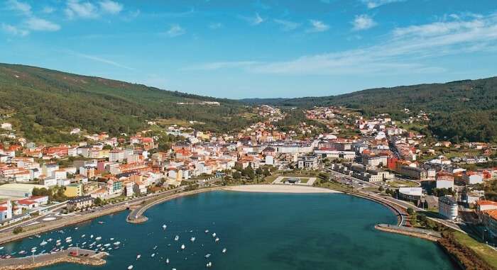
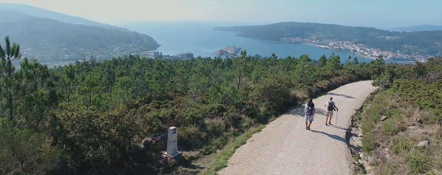
The Route through A Armada is a short but powerful path that overlaps with the entrance of the Camino de Santiago into the municipality of Cee. It offers one of the most memorable views in Costa da Morte—the very first sight of the Atlantic Ocean and Cape Fisterra for pilgrims on their way to the “end of the world”.

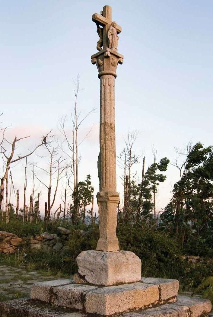
The route begins at the Chapel of San Pedro Mártir, in the parish of Pereiriña, and ascends to the Alto da Armada, where a prominent stone cross (cruceiro) marks a key high point of the journey. From there, it descends into As Campas, part of the Brens parish, blending tradition, natural beauty and industrial heritage.

The Route through A Armada is signposted along the official Camino de Santiago trail. It’s perfect for those seeking a brief yet meaningful walk, culminating in a stunning natural balcony that reveals the sea for the first time. Nearby you’ll find the Virxe da Xunqueira Hospital, Cee’s commercial area, and local services.

Routes and hiking

Other routes on the Costa da Morte

PR-G 158 Costa da Morte Route

Route: Circular Start/finish point: Ruins of the Castle of O Soberano (Camariñas) Length: 22.5...

Carnota Open Museum

Route: Linear Start/finish point: Rieiro – Miñarzo (Carnota) Length: 13 km (one way) Approximate dur...

Through the dolmens of Soneira and Bergantiños

TECHNICAL CHARACTERISTICS of the Route through the dolmens of Soneira and Bergantiños: Total kilom...

Muxía – Os Muíños Route

Route: Circular Start/finish point: Punta da Cruz. Promenade of Muxía Length: 9.2 km (one way) Appr...

Vierio Fidalgo Route. Vimianzo

Route: Circular Start/finish point: Church of San Pedro de Berdoias Length: 9 kms Approxima...

Río Negro riverside walk

The Río Negro riverside walk is one of the most charming routes in the town of Muxía, located in the...

Muxía – Monte Facho Route

Route: Linear Start/finish point: Port of Muxía/ Monte Facho viewpoint Length: 11.4 km (round trip) ...

Camariñas Coastal Blue Trail (RC-2)

Route: linear Start/finish point: Camelle (Camariñas)-Castillo del Soberano (Camariñas) Length: 22 k...

Ponteceso River Walk

Route: Linear Start/Finish Point: Eduardo Pondal Birthplace Length: 2.5 km Approximate duration (r...

PRG148 Ponteceso

Route: Linear Start/finish point: Eduardo Pondal’s birthplace / Puerto de Corme Length: 11.1 k...
Logo Cmat Color Fondo Transparente
Privacy Overview

This website uses cookies so that we can provide you with the best user experience possible. Cookie information is stored in your browser and performs functions such as recognising you when you return to our website and helping our team to understand which sections of the website you find most interesting and useful.