TECHNICAL CHARACTERISTICS of the Route through the dolmens of Soneira and Bergantiños:
- Total kilometers: 43 kilometers.
- Access by vehicle: Dolmen de Dombate, Pedra Vixía (by dirt track) Mina de Recesindes.
Access on foot:
- Fornela dos Mouros: 350 from the place of Aprazadoiro.
- Arquiña de Vilaseco: 80 metres from the road.
- Casota de Freáns: 700 meters from the center of Berdoias.
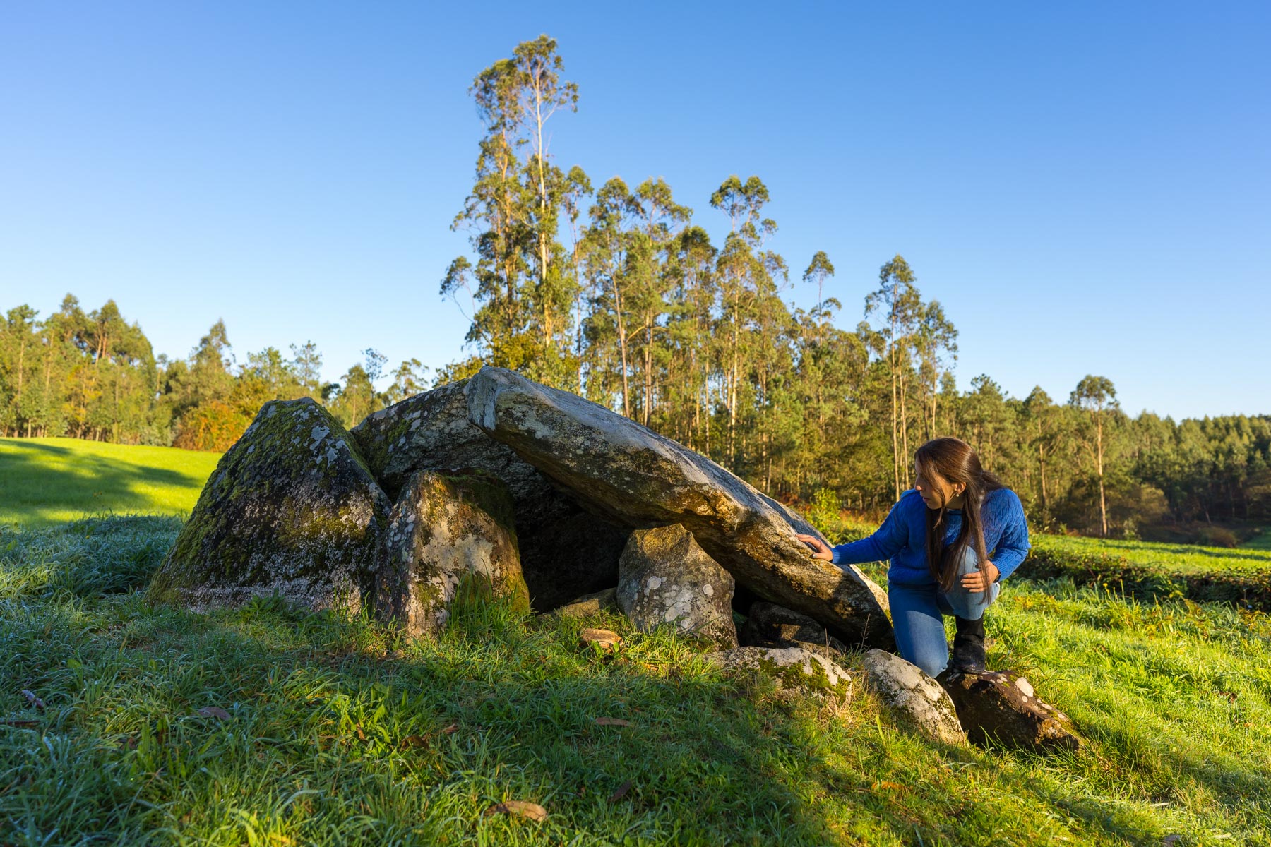
Our route begins with a little-known dolmen, but one that is among the most outstanding in A Costa da Morte. It is Pedra Vixía, almost hidden inside the forest, in the parish of Lamas, in the municipality of Zas. Despite the fact that in the 1950s a neighbor tried to take advantage of its stones for the construction of a house, it still preserves its original structure quite well and the size of the seven stones of the chamber is impressive. Nearby is also the recreational area of Pedra Vixía, a leisure space of great environmental and ethnographic interest located on the banks of the Zas River.
The next stop takes us to what is considered the cathedral of Galician megalithism, the Dombate dolmen. This megalith, sung by the bard Pondal, is one of the best researched today. It is the only megalithic monument in A Costa da Morte that has an interpretation centre to welcome visitors. Dombate impresses with its dimensions, but also with its extraordinary preservation with an almost intact chamber and corridor and a set of anthropomorphic idols placed standing guarding the entrance to the tomb. However, the most spectacular element is the set of paintings inside that visitors can appreciate in a life-size replica located in its interpretation centre.
From Dombate we head to a totally different dolmen. A few kilometres away, in the place of Aprazadoiro, in the municipality of Laxe, we find A Fornela dos Mouros. Its small size and peculiar hut shape suggest that it may be a late dolmen, not from the Neolithic but from the beginning of the Bronze Age, in the second millennium BC. C.
The next stage of the route is an equally unique dolmen located in the municipality of Vimianzo, the Mina de Recesindes. It retains its monumental “mámoa” (tumulus) but the most unique detail is the arrangement of the vertical slabs of its chamber, worked to the millimetre to fit together without leaving a minimum gap between them.
We continue through the town hall of Vimianzo until we reach the Arquiña de Vilaseco, near the place of the same name. Next to the road we find one of the largest mámoas in A Costa da Morte. Its interior houses a dolmen, almost intact, from which some stones emerge at the top.
The last stage leads us to the place of Berdoias. From the interesting village, walking about 700 meters along a path between farmland, right next to the path appears the unmistakable silhouette of the Casota de Freáns, an atypical dolmen, with characteristics similar to the Fornela dos Mouros and which could have been built at the beginning of the Bronze Age. Inside you can see engravings of crosses and bowls. In addition, not far away following a circular hiking route we can visit the petroglyphs of O Pedrouzo.


