Anllons River Walk

Ponteceso

Find out more about Anllons River Walk

  • Route: Circular
  • Start/finish point: Gabenlle Recreation Area
  • Length: 4.3 km
  • Approximate duration (round trip): 50 minutes
  • Difficulty: Easy

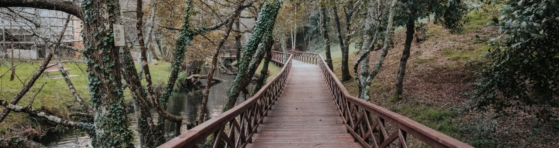
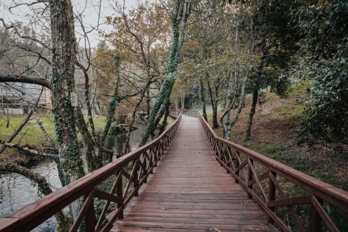
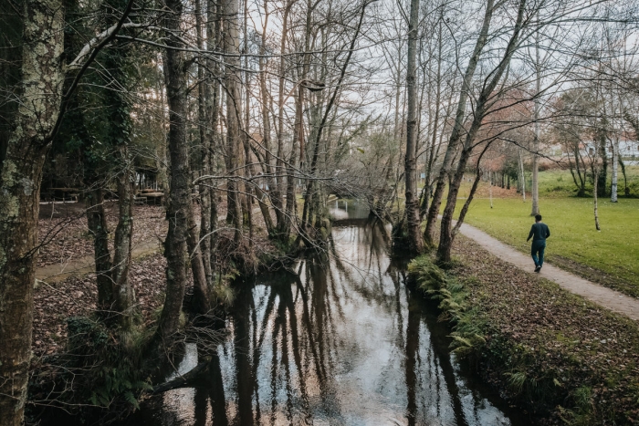
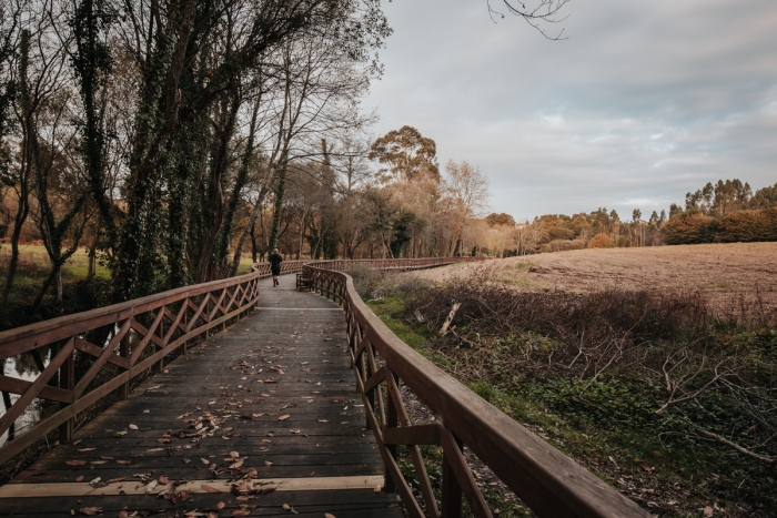
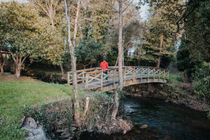
A four-kilometre route that runs entirely along wooden footbridges, completing a section of the Anllóns river as it passes through the municipality of A Laracha. Walkway in good condition with start and end in the beautiful and well-equipped recreational area of Gabenlle.

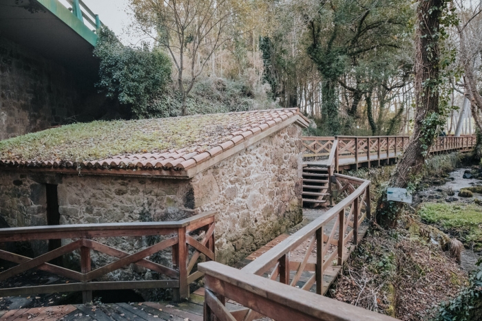
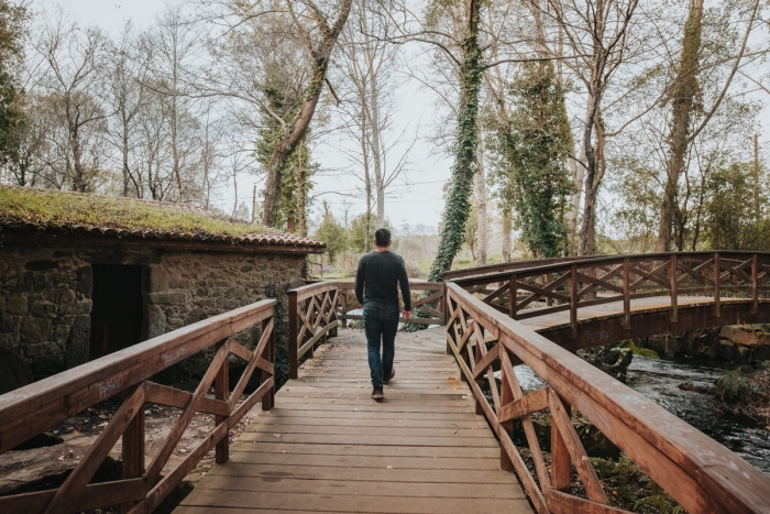
An ideal route to do with children discovering the completely rehabilitated mills that flank this route. These mills are: O Formigueiro, Las Pezas, Grande de Gabenlle and Tarrulo. In them we can discover the configuration and operation of a traditional water mill.

The vegetation of the riverbank is complemented by the view of the crop fields that often reach the same riverbed. A pleasant walk, with educational possibilities and accessible.

After doing the route we can rest in the recreational area and continue the road to the coast. We recommend continuing at the town hall of A Laracha and going to the old whaling port of Caión. At this point begins A Costa da Morte that we can embrace with coastal walks, in the water with baths and surfing or through gastronomy.

Access to the route in our wikiloc profile


Routes and hiking

Other routes on the Costa da Morte

Route Sendas do Mar De Razo a Baldaio

Route: Linear Start/finish point: Porto de Razo. Praia de Baldaio Length: 5.5 km Approximate durati...

Baio river route. Zas

Route: Linear Start/finish point: Baio – Dolmen de Pedra Vixía Length: 3.8 km (one way) Approximate ...

Muxía – Os Muíños Route

Route: Circular Start/finish point: Punta da Cruz. Promenade of Muxía Length: 9.2 km (one way) Appr...

PR-G 158 Costa da Morte Route

Route: Circular Start/finish point: Ruins of the Castle of O Soberano (Camariñas) Length: 22.5...

Mount Pindus. Views of the Atlantic

Route: Linear Start/finish point: Church of Pindo – A Moa Length: 4.00 km (one way) Approximat...

Water Route. Zas

Route: Circular Start/finish point: Ponte do Sisto (Zas) Length: 10 km. Approximate duration: 2.5 ho...

Vierio Fidalgo Route. Vimianzo

Route: Circular Start/finish point: Church of San Pedro de Berdoias Length: 9 kms Approxima...

PRG148 Ponteceso

Route: Linear Start/finish point: Eduardo Pondal’s birthplace / Puerto de Corme Length: 11.1 k...

Ponteceso River Walk

Route: Linear Start/Finish Point: Eduardo Pondal Birthplace Length: 2.5 km Approximate duration (r...

PRG-142 Route of the waterfalls. Carballo

Route: Linear Start/finish point: Brea – Entrecruces (Carballo) Length: 18.6 km (one way) Approximat...
Logo Cmat Color Fondo Transparente
Privacy Overview

This website uses cookies so that we can provide you with the best user experience possible. Cookie information is stored in your browser and performs functions such as recognising you when you return to our website and helping our team to understand which sections of the website you find most interesting and useful.