The territory of A Costa da Morte, due to its peripheral location, was not crossed in ancient times by any major routes of communication. The only one of note—if we take into account the views of some historians—would be the Roman road XX, also known as Per loca maritima, which, after crossing the bridge of Brandomil and entering the region of O Xallas, would reach Bergantiños heading towards Carballo, and then continue on to Brigantium (A Coruña).
The ancient communication arteries of A Costa da Morte led mainly towards Santiago and A Coruña. The roads to these two cities crossed the rivers Xallas, Porto and Anllóns by means of several bridges. Over the Xallas, the two most important were the Olveira bridge and the Brandomil bridge. Over the river O Porto, the most significant was the bridge at A Ponte do Porto. On the Anllóns, the two most substantial were the Ponteceso bridge and the Lubián bridge.
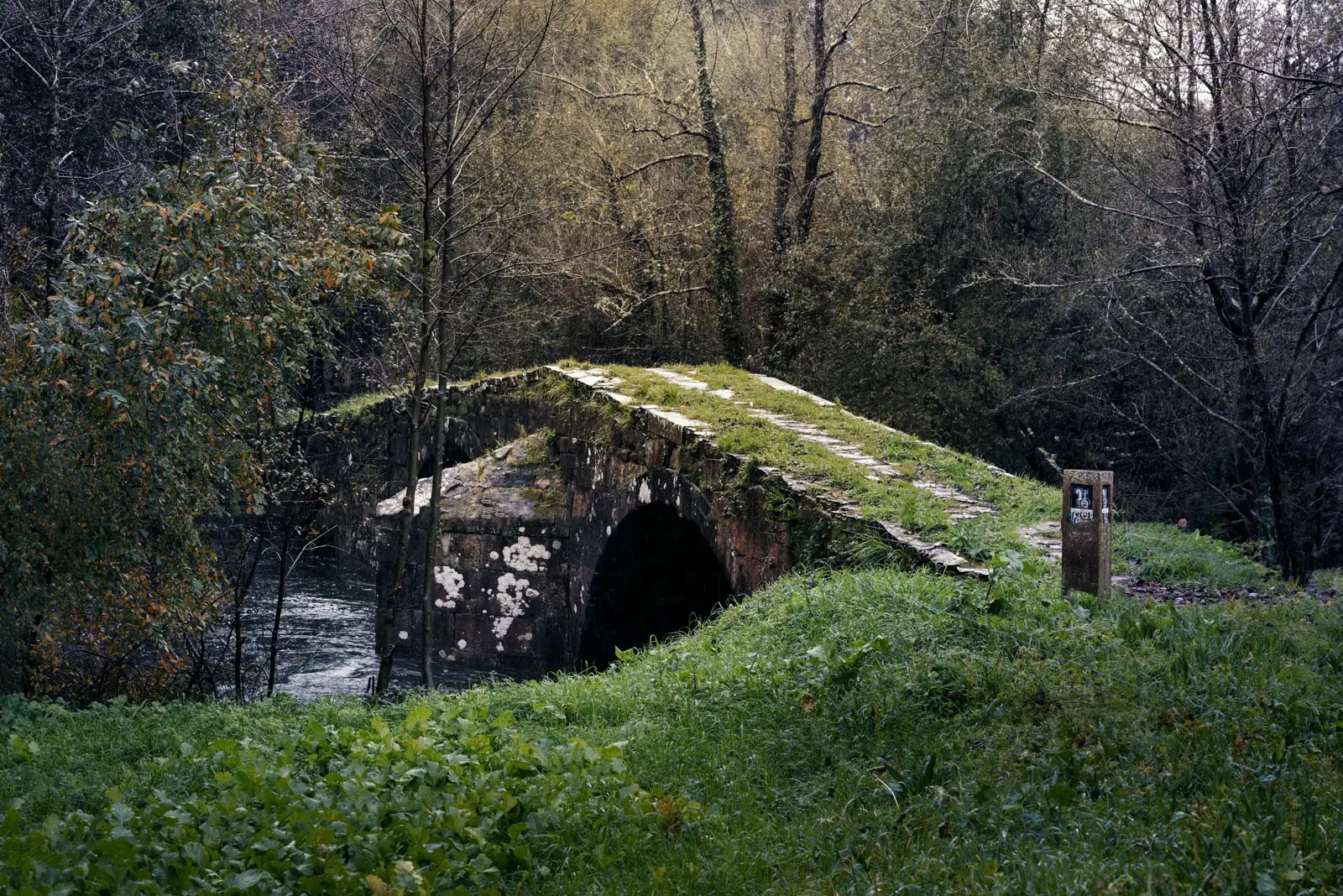
Some argue that where this latter bridge stands, there was an earlier one, across which that hypothetical road XX would have passed. Part of the local population still refers to it as “the Roman bridge”. Carré Aldao, when describing the parish of Oca (Coristanco), tells us that there are two bridges over the Lubián river: Old and New. Of the former he states: “The Old bridge has a humped back and was built by the Romans on the road that passed through these places.” However, the old bridge we see today dates from the 18th century, as the learned Coruñan José Cornide confirms: “it was built only a few years ago and is very well preserved.”
On the map by Tomás López (1784) this bridge appears under the name “Lubián bridge”, and together with the Ponteceso bridge, they are the only ones he mentions over the Anllóns. Of course, the Lubián bridge is also named on Domingo Fontán’s map (1845), but in that case several others are included as well, such as Anllóns, Cardezo, Pontedona, Verdes and Garga.
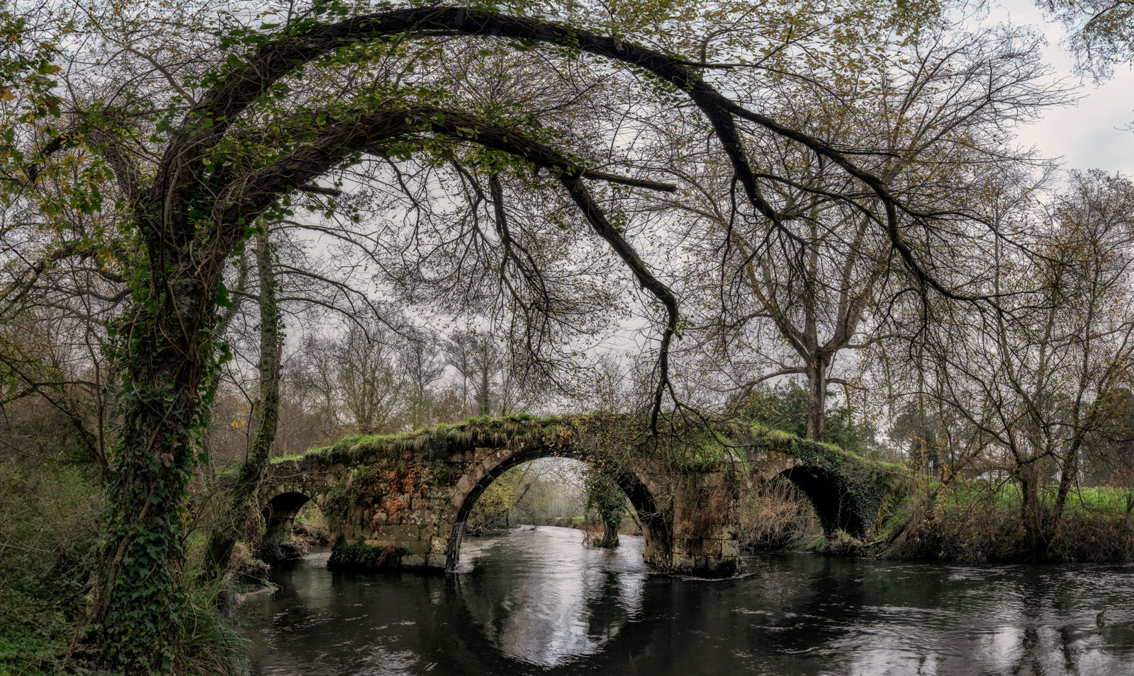
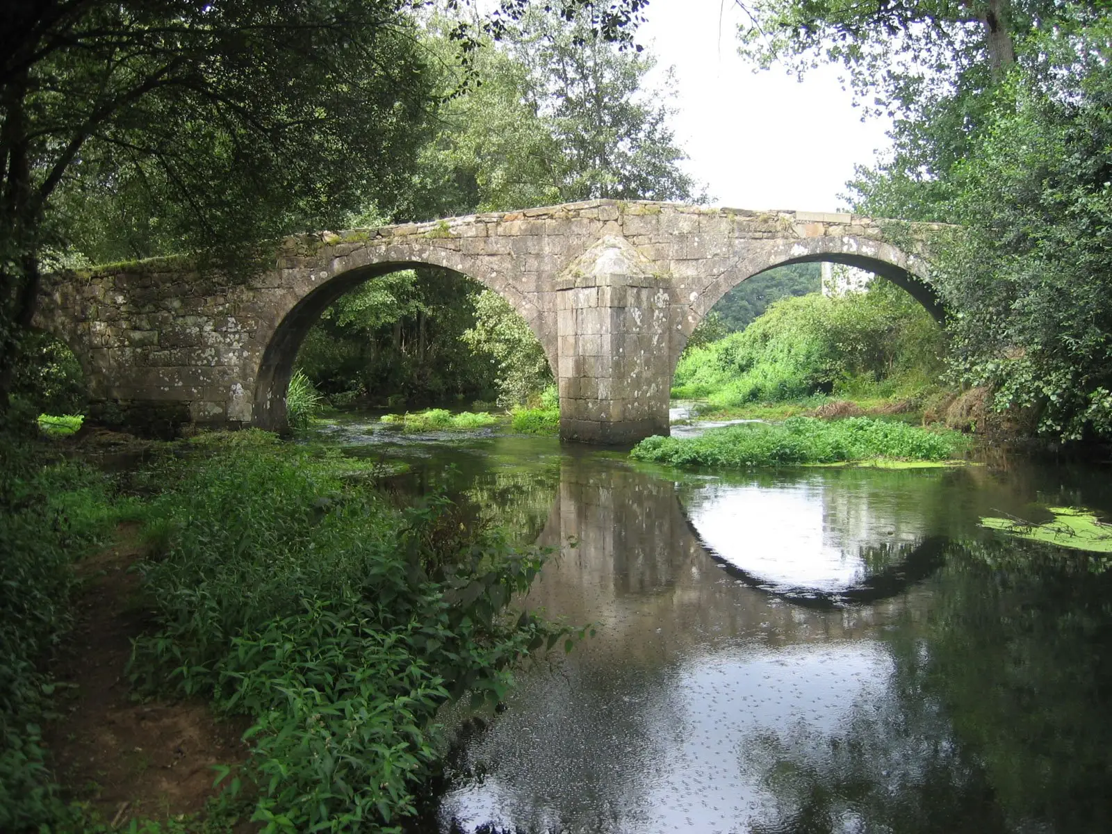
The Lubián bridge stands on the boundary between the municipalities of Coristanco and Carballo, very close to the AC-552 road, and is regarded as the finest surviving construction of its kind in Bergantiños. It is therefore one of the most outstanding historical monuments in the region. In 1984, one of its smaller arches collapsed as a result of a major flood, but the damage was repaired and it is currently in good condition.
The arches that make it up are asymmetrical: two large-diameter arches on the north side, through which the river’s flow runs, and two smaller ones on the opposite side. Its structure is reinforced by a cutwater between the two larger arches. It has a narrow carriageway (2.60 m), with a hump that reaches its highest point at the pier supporting the two widest arches. The old royal road that ran from the city of A Coruña towards the regions of Bergantiños, Soneira and Fisterra crossed here, and it fell out of use when the AC-552 road was built in the mid-19th century and a new bridge was erected to the north of the previous one.


