In the 1920s, the Muxiá poet Gonzalo López Abente already considered Cape Touriñán to be the westernmost point in Galicia, and called it this in one of his poems: “the longest finger on the Galician hand”.
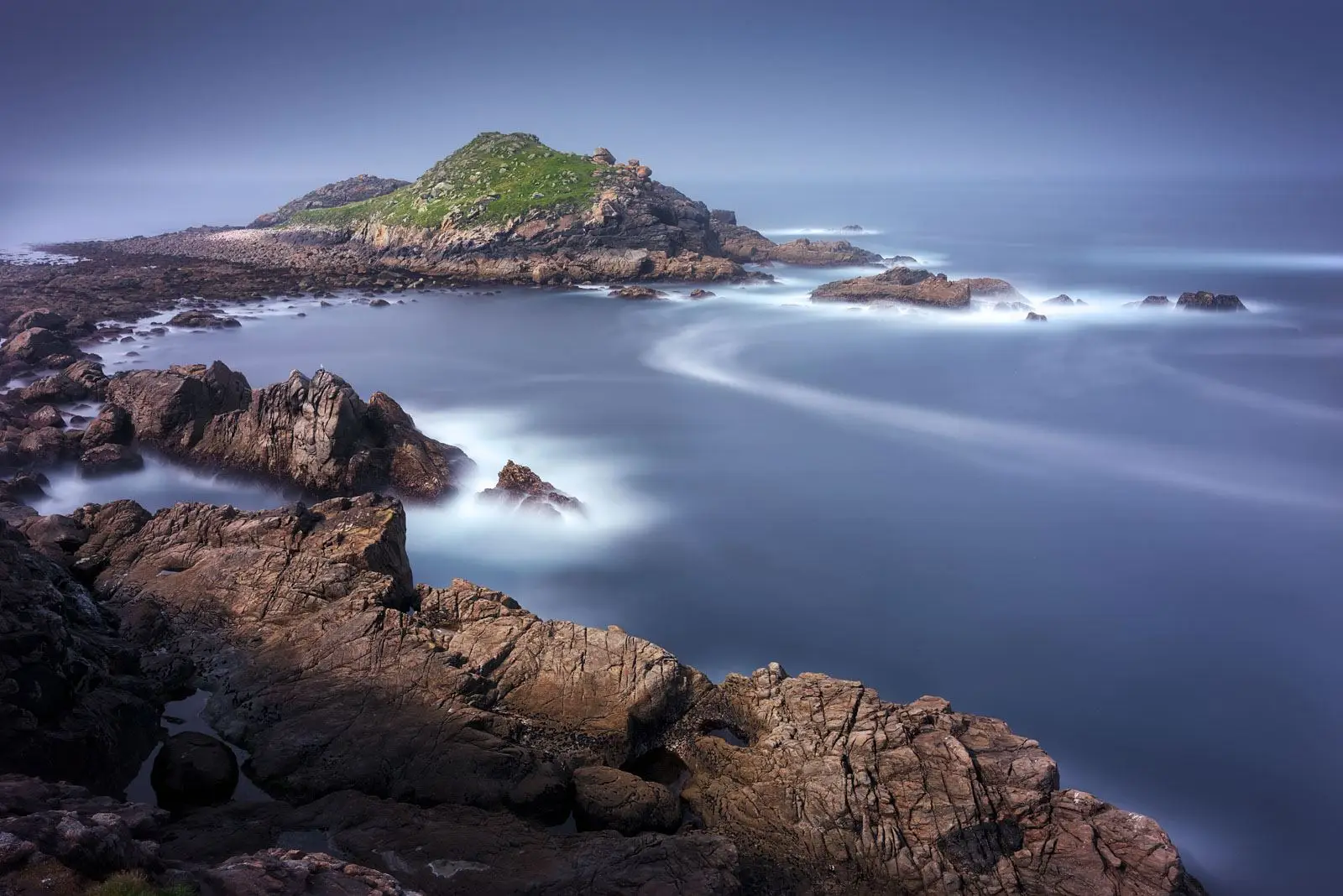
Cape Touriñán is a wild tongue of land, on which no trees grow as it is whipped by the wind and salt, so that so plants grow here other than a low covering of heather and ling. The peninsula formed by this promontory sticks out into the ocean in a north-easterly direction and ends at Gaivoteira Point.
All the shoreline of this peninsula consists of a rocky, irregular coast with steep cliffs, especially in the area closest to the lighthouse, and dangerous shallows that form real traps for the vessels that sail through this area. The best-known and most hazardous of these is the Laxe de Touriñán, a reef a quarter of a mile to the west of this point on which numerous shipwrecks have occurred.
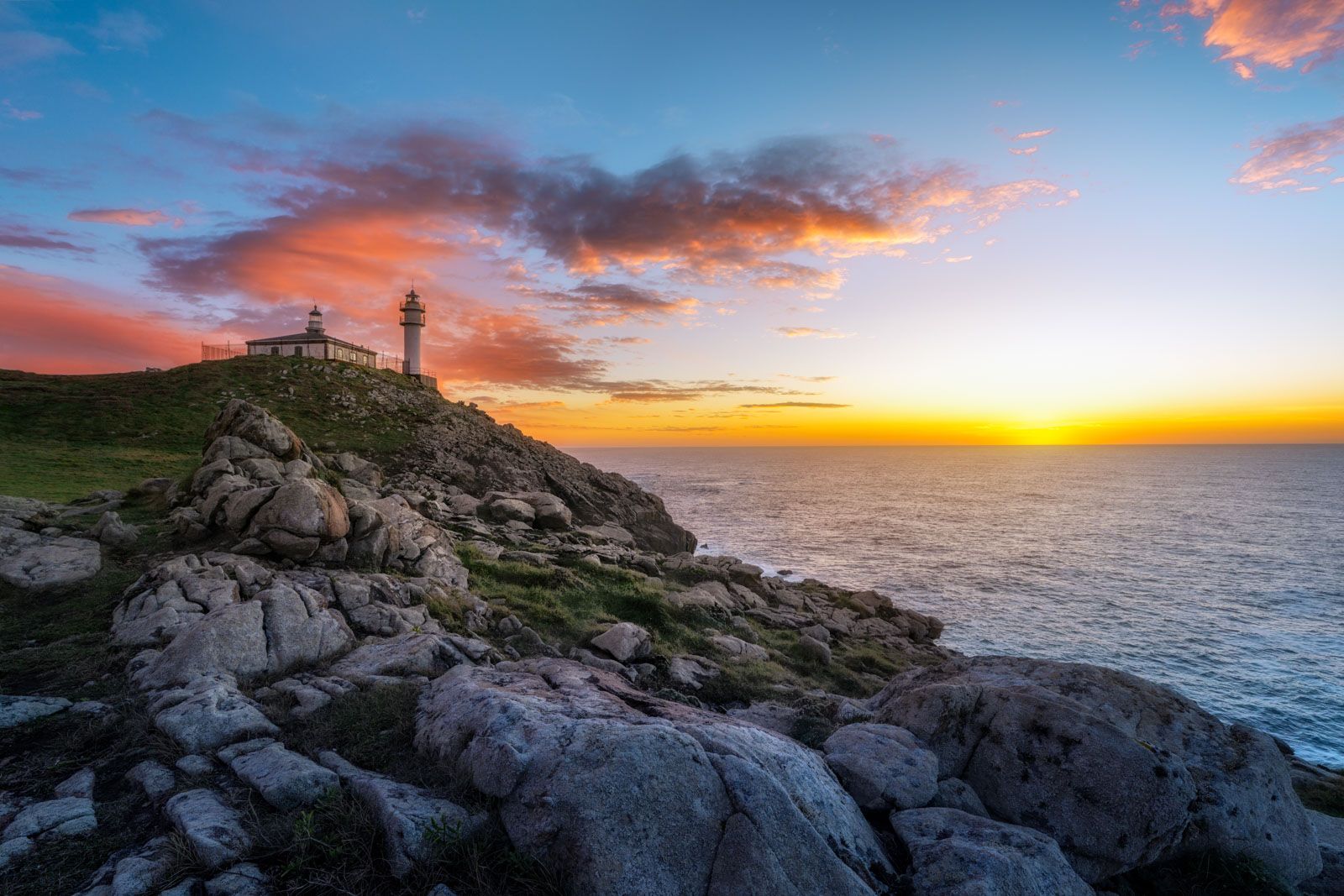
On the western side is the Herboso or Castelo, an islet separated from the land by a cove, which can be accessed at low tide. Its name refers to a possible fortified settlement that could have existed here. Also to the west is the lighthouse, which has two buildings: the old lighthouse and the present-day tower.
The General Maritime Lighting Plan of 1847 contained the idea of erecting a category one lighthouse on Cape Touriñán instead of Cape Fisterra, arguing that there should be two main maritime signalling points between A Coruña and Fisterra, one on the Sisargas islands and one on this point by Muxía, but the original idea was rejected and the category one lighthouse was built in Fisterra and only a category four in Touriñán.
The original plan for the lighthouse was drawn up by Adolfo Pequeño, one of the engineers who designed the new Vilán lighthouse. It shows a simple rectangular building 14 m long with the openings faced in granite and the rest painted white. A small tower sticks up in the centre of the roof, surrounded by a balcony with an iron railing, where a light with flat glass panels and vertical uprights, with an optic taken from the old Vilán lighthouse, would be installed.
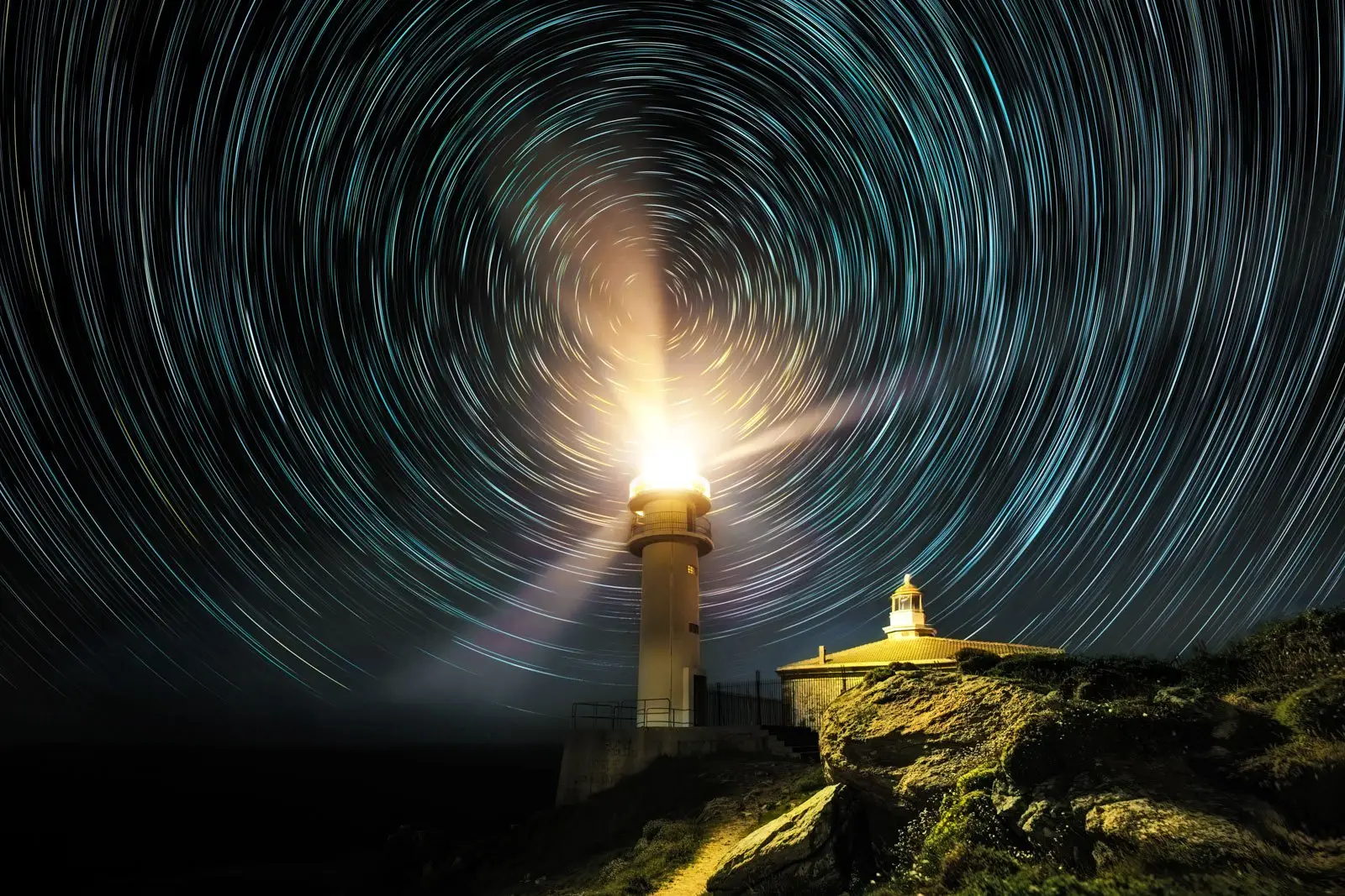
It came into operation at the end of 1898 and was one of the last lighthouses in Galicia built in the 19th century. It emitted a white beam with a range of 10 miles, produced by a Mares paraffin light. In 1918 the optic was changed and a new light installed that operated on pressurised oil vapour and had a range of 20 miles. In 1981 the cylindrical concrete tower of the new lighthouse was built, which operated with an 1500 W electric light and projected its beam to a distance of 24 miles.
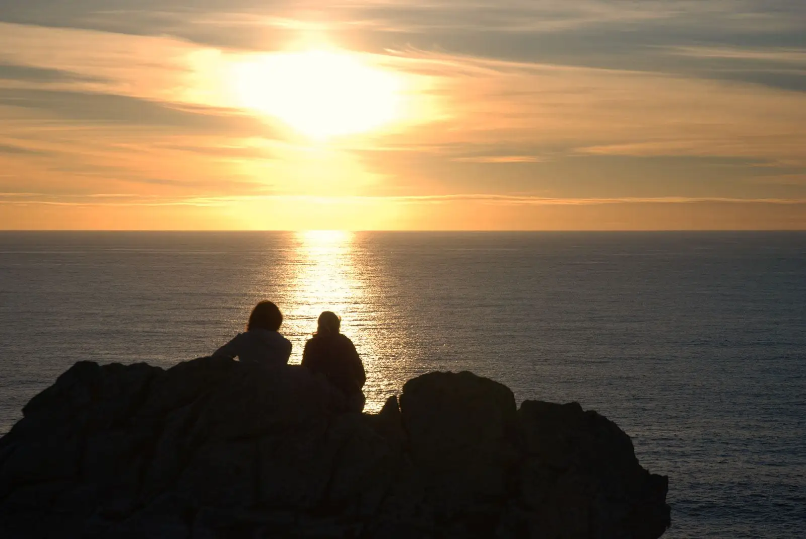
Cape Touriñán is the most westerly point of continental Spain (Coordinates: 43o 03’ 20’’ lat. N and 9º 17’ 54’’ long. W). There are two periods during the year when the last rays of sun in Europe set on this promontory. The first is between 21st March and 23rd April, and the second between 13th August and 22nd September, according to a study made by the Baión physicist Jorge Mira Pérez. Touriñán takes over from Cape Roca, in Portugal, and passes it on to Vardetangen, in Norway. This fact forms another attraction for visitors to the most westerly point of Galicia.


