Casota de Freáns (Vimianzo)

Culture and history, Megalithism, Prehistory
Vimianzo

Find out more about Casota de Freáns (Vimianzo)

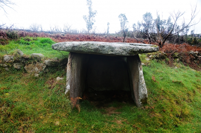
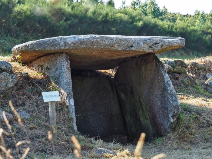
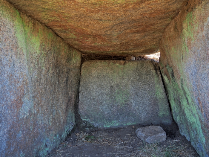
From grave to shepherd’s refuge

The particular shape of the Casota de Freáns meant that for many years the shepherds used it as a refuge to protect themselves from the inclemency of the weather. In fact, it is an atypical dolmen since it has no chamber, no corridor, no earth mound. Its structure is very similar to the Fornela dos Mouros (Laxe) because it consists of three vertical granite slabs on which a horizontal one rests that serves as a roof or roof, forming a kind of hut.

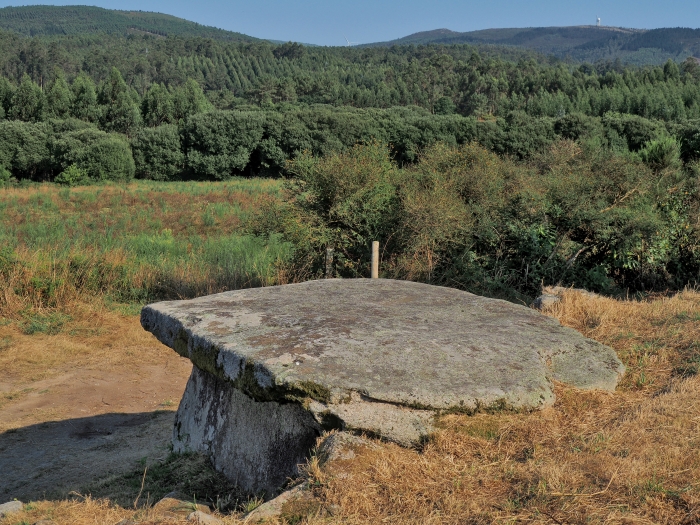
The characteristics of the megalith are reminiscent of later megalithic cists and could be dated to the early Bronze Age, as early as the second millennium BC. These monuments would have functioned as individual burials and typically lacked the monumentality of large corridor dolmens.

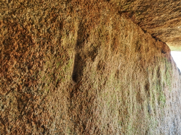
Inside the Casota, on the vertical slabs, several engravings based on crosses and “bowls” can be seen quite clearly. The meaning is not clear, although some authors have related these “bowls” to the representation of constellations of stars. This hypothesis is quite controversial today, but the link between dolmens and astronomical phenomena is clear. Perhaps the most obvious is the orientation of the corridors and accesses of the vast majority of the monuments of Western Europe towards the southeast in relation to the sunrise and sunrise.

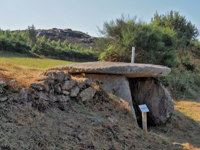
A Casota de Freáns is located on the eastern slope of Monte Pedrouzo. On the opposite side of this hill, about 500 meters from the dolmen, several sets of petroglyphs with bowls, concentric circles and other motifs that could be related to the megalith were found in 2004. Through the Vieiro Fidalgo hiking route you can complete the visit with this set of rock art.

Lighthouses, rivers, beaches and much more on the Costa da Morte

Other places of interest in Vimianzo

Pedra da Lebre (Vimianzo)
The mystery of the paintings A Pedra da Lebre is the beautiful name of a dolmen...
Pazo de Trasariz
This pazo with an attached chapel has on the ground floor a portico of eight arc...
San Bartolo Viewpoint
From a height of more than 400 meters, the San Bartolo viewpoint offers a panora...
Through the dolmens of Soneira and Bergantiños
TECHNICAL CHARACTERISTICS of the Route through the dolmens of Soneira and Bergan...
Arquiña de Vilaseco (Vimianzo)
The tumulus that hides a dolmen Protected by a huge mound of earth, which reac...
Pedra Moura do Monte Cárneo (Vimianzo)
A dolmen in the middle of the meadow Pedra Moura is the evocative name of a meg...
Vimianzo: Mirador de San Bartolo
In Vimianzo the highest place is occupied by the viewpoint of San Bartolo. The t...
Arca do Rabós (Vimianzo)
Walking among burial mounds Walking through a meadow, we see in a tree plantati...
Sabadelle Beach
Between Traba and Camelle, in the parish of Carantoña, is the cove of Sabadelle,...
Megalithic Corridor Route
SPECIFICATIONS: Total kilometers: 41 kilometers. Access by vehicle: Pedra Cubert...
Logo Cmat Color Fondo Transparente
Privacy Overview

This website uses cookies so that we can provide you with the best user experience possible. Cookie information is stored in your browser and performs functions such as recognising you when you return to our website and helping our team to understand which sections of the website you find most interesting and useful.