- Route: circular
- Start/finish point: O Ariño Beach (Camariñas)
- Length: 3.5 km.
- Approximate duration (round trip): 1 hour
- Difficulty: Easy
This route owes its name to Monte da Insua, which separates the Ensenada da Basa from the mouth of the Rio Grande.
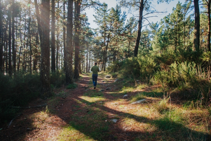
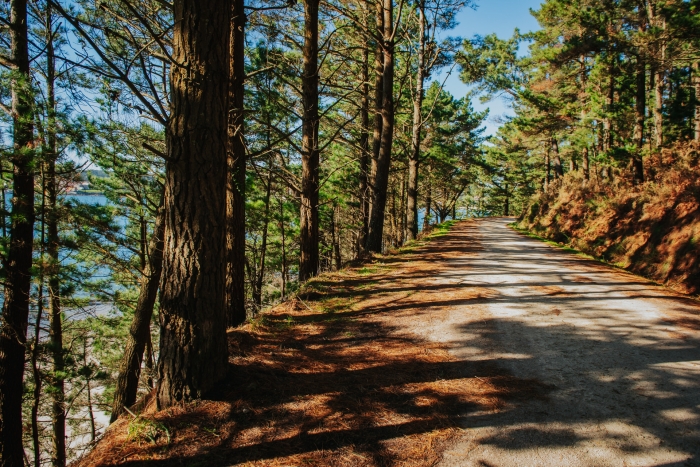
The path runs along the dirt track of the coast but, if we have low tide, we can also do it on the sand.
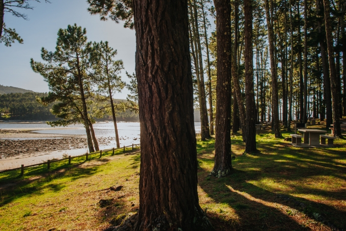
The route starts at the beach and recreational area of O Ariño (Camariñas), an area with parking, showers, toilets, benches, tables and grills, so we can enjoy some rest time before starting the route.
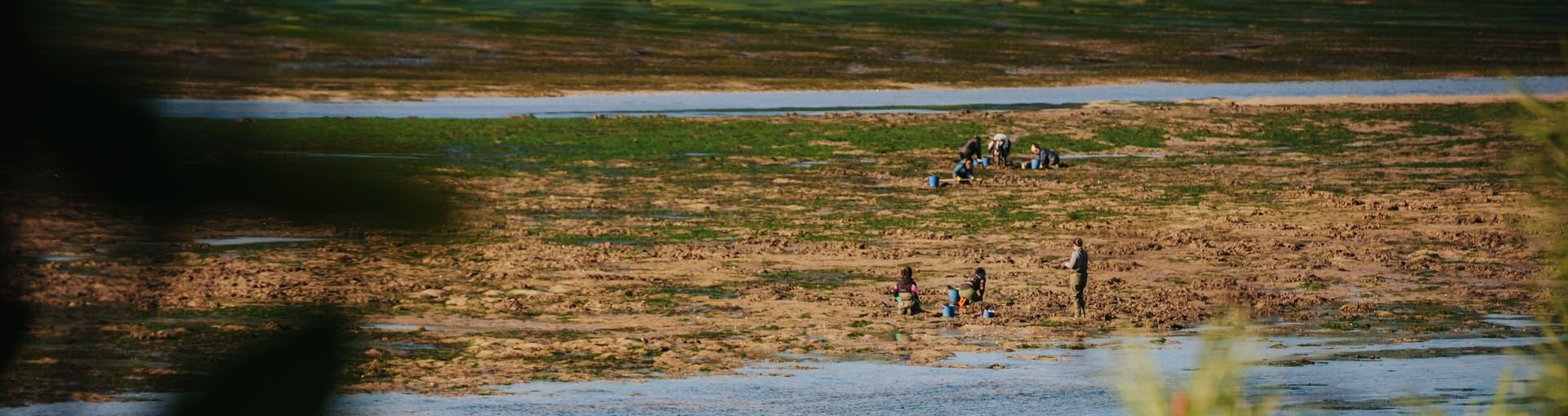
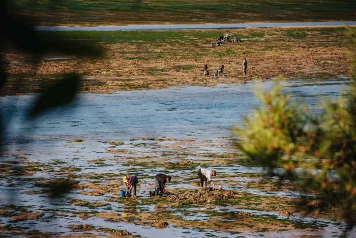
In this area we can observe the work of the shellfish gatherers of Camariñas.
We continue the path until we reach the next beach, Rego dos Coiros, a beach of fine white sand from which we can see the other side of the estuary.
The third beach that is part of this route and our next stop is Ariña Blanca.
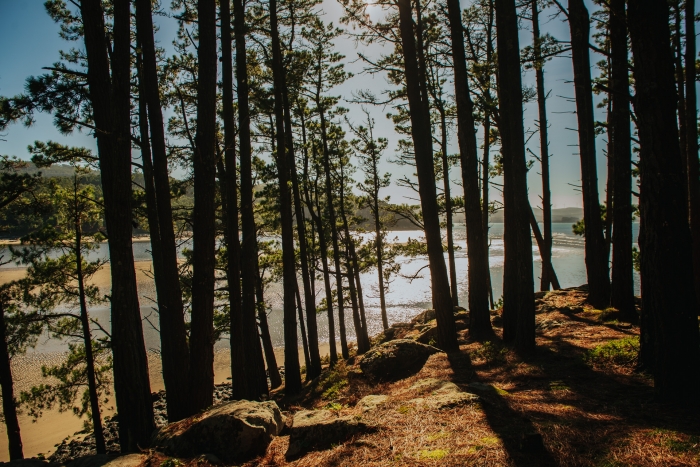
A sheltered beach, with calm waters and surrounded by pine forests.
We start walking again taking a detour to the right, ascending about 100 meters to the Alto da Insua.
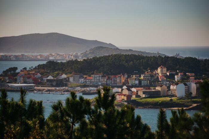
It is the highest point of the route and the one that offers us panoramic views of the entrance to the estuary, the marina and fishing port of Camariñas, the beaches of Lingunde and Area de Vila and diverse heritage such as the Hermitage of the Virgen del Monte.
Continuing along the main road, we find the remains of an old tungsten mine (Mina Amparo).
This mineral had a high value in the last century for its use in the manufacture of weapons in World War II.
After taking a detour from the route, we arrive at the Agramar spring, a natural spring that rises at the edge of the sea at high tide in contact with salt water.
As the end point of this route, we arrive at the mouth of Lamastredo.
We will link up with the access road to O Ariño and in a round trip derivation, we will end up at the mouth of this river, from which we will be able to contemplate the Pazo de Paxariñas (built in the sixteenth century in San Pedro de Ponte en Dor, where the dovecote and the chapel still remain).
In this final section of the route, in the area of the estuary also called Vatel, we will be able to enjoy the activity of the shellfish banks.
An ideal route to enjoy in a group or with the family, with a recreational area where you can spend part of the day and various beaches where you can stop for a swim, if the weather permits, or enjoy the sound of the sea in a quiet environment.
The well-kept and equipped recreational area of O Ariño stands out and above all the possibility of observing the hard work of the shellfish gatherers.
Access to the route in our wikiloc profile


