Devesa da Lúa Oak Grove

Natural spaces
Dumbría

Find out more about Devesa da Lúa Oak Grove

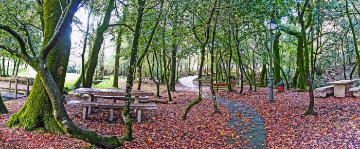
An open natural area where a large number of oak trees are found on the banks of the river that crosses it. It is known as “A Devesa da Lúa” because it is shaped like a crescent. It is a nice path for a walk; with walkways, wooden bridges and river mills that make this place a charming place to escape.

In the surroundings of the oak grove, you can see the fort of Berdeogas (unexcavated), the Church of Santiago de Berdeogas, a dovecote and a granary. The granaries had the function of granary, as storage for the harvest. In this case, due to the fact that it is so close to the church and the rectory, in addition to having a very good stone in its construction, it must have belonged to the clergy or to the wealthiest families of the parish. This one in particular is a unique granary both for its size and for its morphology. It is the longest in the municipality of Dumbría and is irregular. It does not have even feet, but has 15 in the north and 16 in the south.

The Family Festival is celebrated here, on the Sunday of the last fortnight of July, where the families of the region meet to enjoy a day together in the countryside. There is mass, traditional music and dance, empanada, churrasco and wine. It is a festival promoted by the City Council.

+information

Lighthouses, rivers, beaches and much more on the Costa da Morte

Other places of interest in Dumbría

Fervenza do Ézaro
It is located about 700 m east of the centre of O Ézaro, next to the Castrelo hy...
Cores Cemetery
It is the second municipal cemetery in Dumbría and is next to the municipally-ow...
Devesa da Lúa Oak Grove
An open natural area where a large number of oak trees are found on the banks of...
Through the dolmens of Soneira and Bergantiños
TECHNICAL CHARACTERISTICS of the Route through the dolmens of Soneira and Bergan...
Dolmen Pedra da Arca de Regoelle
The Dolmen of Pedra da Arca is also known as the Dolmen of Regoelle. It has a po...
Dumbría: Pedra Cabalgada or Brazal
Also known as Pedra do Brazal. It stands out as an astronomical observation poin...
Ponte Olveira
It was possibly built in the sixteenth century on the bed of the Xallas River. M...
Megalithic Corridor Route
SPECIFICATIONS: Total kilometers: 41 kilometers. Access by vehicle: Pedra Cubert...
Ézaro Viewpoint
In Ézaro you can not only visit its spectacular waterfall at the mouth of the Xa...
Curso Bajo, Cascadas y Desembocadura del Ría Xallas (Dumbría)
A Site of Spanish Geological Interest of International Relevance (also defined a...
Logo Cmat Color Fondo Transparente
Privacy Overview

This website uses cookies so that we can provide you with the best user experience possible. Cookie information is stored in your browser and performs functions such as recognising you when you return to our website and helping our team to understand which sections of the website you find most interesting and useful.